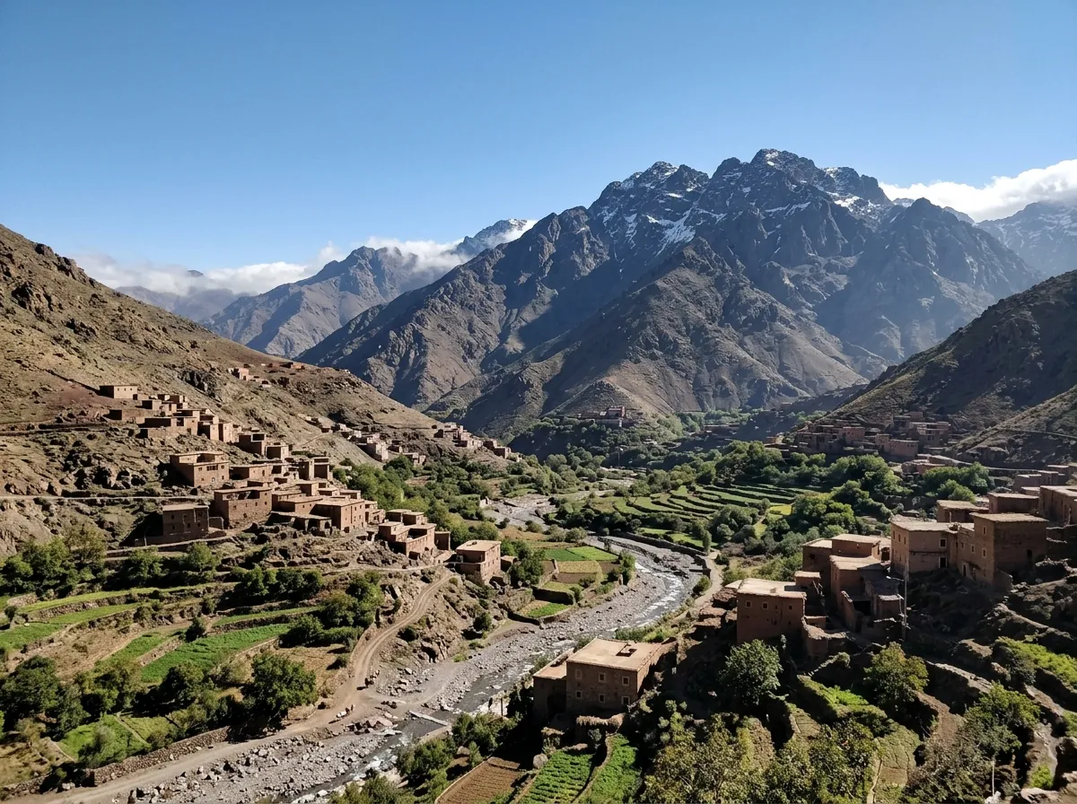
Atlas Day Trekking & Mountain Biking
This Atlas Day Trekking & Mountain Biking guide covers day-trip logistics around Imlil in the High Atlas, including trail distance, elevation gain, walking duration, difficulty grading, local guide regulations, interactive satellite mapping, and draft cost estimates to confirm locally before setting out.
 By Youssef El AmraniOverland & Mountain Route Specialist
Save numbers offline before leaving Marrakech (Official UK FCDO Guidance ↗)
Atlas Day Trekking & Mountain Biking: Guide Rules, Coverage & Route Specifications
Before departing Marrakech for the High Atlas, review the official guide regulations, verifiable mobile network coverage sources, and exact distance, elevation, walking duration, and difficulty parameters for each trail sector around Imlil.
| Route Option around Imlil | Total Distance | Elevation & Ascent | Walking / Riding Duration | Difficulty Level | Guide Requirement |
|---|---|---|---|---|---|
| 1. Imlil ↔ Aroumd Valley Loop (Trail Specs ↗) | ~2.3 km one-way (~4.6–5 km return) | 1,740 m → 1,960 m (+218 m ascent) | 1h 30m – 2h 30m active walk | Easy–Moderate (2/5) · Graded mule path & stone terraces | Optional on main village path; recommended for cultural context & side trails |
| 2. Imlil ↔ Tizi n’Tamatert Pass (Pass Guide ↗) | ~10 km return (~5 km each way) | 1,740 m → 2,279–2,287 m (+512–540 m ascent) | 4h – 5h return walk (or ~2.5h–3.5h MTB climb & descent) | Moderate (Trek) / Grade 3–4 (MTB) · Sustained climb through walnut & pine forest | Strongly recommended for pass junctions, MTB spotter support & local check-ins |
| 3. Tizi n’Tamatert → Talamrout Ridge / Tacheddirt (Summit Info ↗) | ~12.5 km – 13 km return / loop | 1,740 m → ~2,600 m (+850 m+ cumulative gain) | 5h – 7h full-day mountain outing | Moderate–Challenging (4/5) · Steep rocky crest, thinner air & wind exposure | Licensed mountain guide (Ministry of Tourism) essential for ridge safety |
Illustrative 1-Day Budget for Two Travelers
The figures below are draft planning estimates in MAD for two adults, not official rates or live quotes. They have not been independently verified for this update. Confirm transport, guide, equipment, meal and parking prices locally before relying on the totals.
| Logistics Category | Budget Route (Shared Transit) | Self-Drive Comfort (SUV Rental) | Private Agency / VIP Concierge |
|---|---|---|---|
| Roundtrip Marrakech Transit | 200 MAD · Shared Grand Taxi | 600 MAD · Fuel & Rental Car | 1,600 MAD · Private Van & Driver |
| Secure Parking Fee | 20 MAD | 30 MAD · Central Imlil Lot | Included in Driver Service |
| Certified Mountain Guide | 400 MAD · Bureau Roster Desk | 500 MAD · Dedicated Private Guide | 800 MAD · Specialist MTB / Alpine Lead |
| Trail Equipment / Bike Rental | 200 MAD · Trekking Poles & Daypacks | 900 MAD · 2x Hardtail Mountain Bikes | 1,800 MAD · 2x Full-Suspension Enduro Bikes |
| Traditional Berber Lunch | 140 MAD · Village Homestay Tajine | 220 MAD · Panoramic Terrace Restaurant | 400 MAD · Kasbah du Toubkal Dining |
| Trail Hydration & Energy | 60 MAD · Bottled Water & Walnuts | 100 MAD · Energy Packs & Fresh Citrus | 150 MAD · Organic Dried Fruit & Electrolytes |
| Total Outlay (2 Persons) | 1,020 MAD | 2,350 MAD | 4,750 MAD |
Planning to spend the night in the High Atlas? Explore our curated inventory of boutique stays and mountain lodges on Best Riads in Morocco, or reserve your vehicle directly via Car Rental in Morocco.
Must-Pack Mountain Hardware & Local Supplies
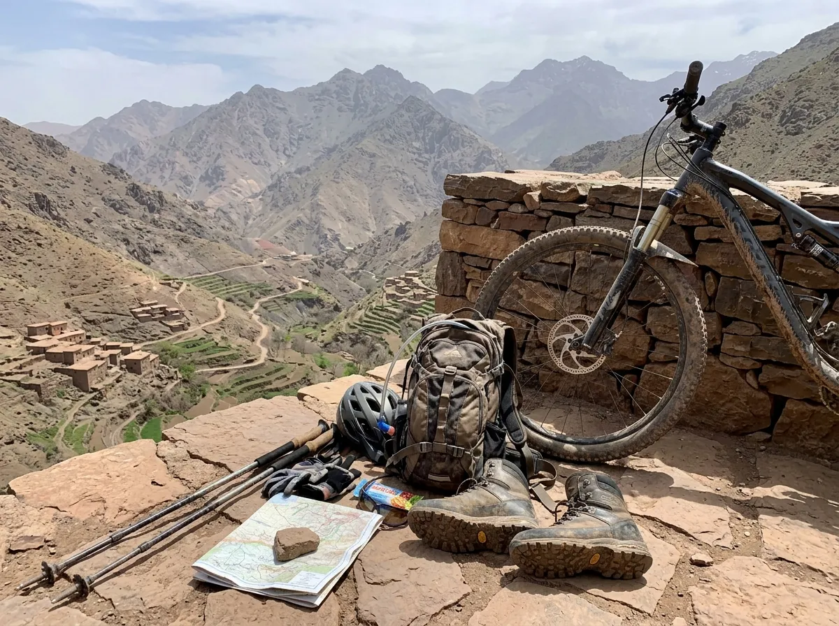
Braking & Suspension Standards for MTB
Mule paths crossing Tizi n’Tamatert (2,279 m) present steep scree, loose granite boulders, and sharp drop-offs. Avoid attempting technical descents on worn rim brakes or city bicycles. Hydraulic disc brakes and wide-tread mountain bike tires are strongly advised to reduce brake fade and pinch flats. Review our packing checklist at Morocco Travel Essentials.
Trekking Support & Hydration Protocols
High solar radiation combined with dry mountain air accelerates dehydration above 2,000 meters. Pack at least 2 liters of treated or sealed water per person and supplement with electrolytes. Sturdy hiking boots with ankle support protect against loose stones when crossing dry alluvial fans. Stock up on sealed bottled water, almonds, and dried figs in Imlil before ascending.
Where to Source Gear in Imlil:
Ask locally which equipment is available to rent, its current price and mechanical condition. Availability changes seasonally. Arrange mountain bikes in advance with a vetted operator and confirm the exact frame size, brake condition, helmet, and route suitability.
Atlas Day Trekking & Mountain Biking: Sample Imlil Day Plan
For an Atlas day trekking and mountain biking outing, use this schedule as a planning outline rather than turn-by-turn navigation or a guarantee of trail access. Route distance, elevation gain, walking duration, difficulty, weather and local guide requirements vary. Confirm the exact trail and conditions with a qualified local guide or relevant authority before departure.
Marrakech to Imlil: Transfer & Guide Verification
- Road Distance: ~64 km (Marrakech to Imlil)
- Drive Duration: ~1h 30m each way
- Road Corridor: R203 to Asni → P2017 to Imlil
- Elevation Gain: 466 m (Marrakech) → 1,740 m (Imlil)
- Guide Requirement: Verify credentials & trail rules at Bureau des Guides
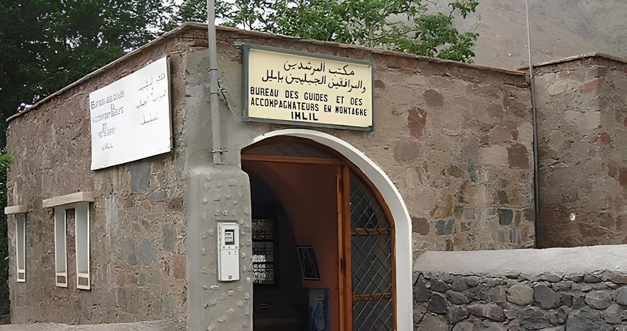
Trailhead Arrival & Guide Credential Check
Depart central Marrakech around 07:00 via Route Régionale R203 through Tahanaout into the Asni valley basin, then branch south onto Route Provinciale P2017 winding alongside the river gorge up to Imlil (1,740 m).
On arrival, confirm the official parking area and check in at the Bureau des Guides. Ask which guide and registration rules apply to your chosen trail, verify the guide’s official card (Ministry of Tourism), and agree on the exact route, walking time, and total fee before setting off. For broader trip planning, consult our first-time Morocco guide.
Aroumd Terraces & Tizi n’Tamatert Pass Ascent
- Trail Distance: ~4.6 km return (Aroumd) or ~10 km return (Tizi n’Tamatert)
- Walking Duration: ~2h (Aroumd) or 4h–5h return (Tamatert Pass)
- Elevation & Ascent: 1,740 m → 1,960 m (+218 m) or 2,279 m (+512–540 m)
- Difficulty Level: Easy–Moderate (Aroumd) / Moderate (Tamatert Pass)
- Guide Requirement: Recommended for pass junctions & local checkpoints
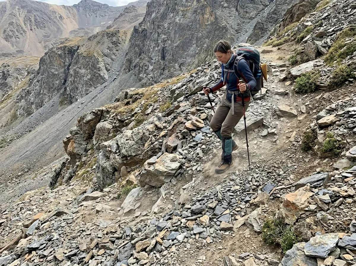
Ascending Ancient Amazigh Farming Terraces & Pine Ridges
Hikers looking for a shorter morning walk can follow the mule path through Aït Souka walnut orchards up to the moraine terrace of Aroumd (~2.3 km one-way, +218 m elevation gain, rated Easy–Moderate per FriendHike). Walkers aiming for the classic pass view continue east through Tamatert village and pine forest to the Tizi n’Tamatert col at 2,279–2,287 m (~10 km return, +512–540 m vertical ascent, 4–5 hours round-trip per Riad Jnane Imlil and Atlas & Sahara Tours).
Fit trekkers with an early start and a licensed mountain guide can optionally extend the climb above the pass along the rocky crest to Talamrout Summit (~2,600 m, Moderate–Challenging, 5–7 hours total). Confirm turnaround times and weather conditions with your guide, or explore multi-day routes in our 10-day Morocco itinerary.
Pass Descent, MTB Trail Options & Marrakech Return
- Trail Distance: ~5 km descent to Imlil or ~12.5–13 km loop via Imnane Valley
- Elevation Change: -539 m to -690 m vertical descent
- Active Duration: ~2h – 3h afternoon descent & valley return
- Difficulty Level: Moderate on foot · Grade 3/4 rocky singletrack by MTB
- Guide Requirement: Strongly advised for MTB trail sharing & hamlet navigation
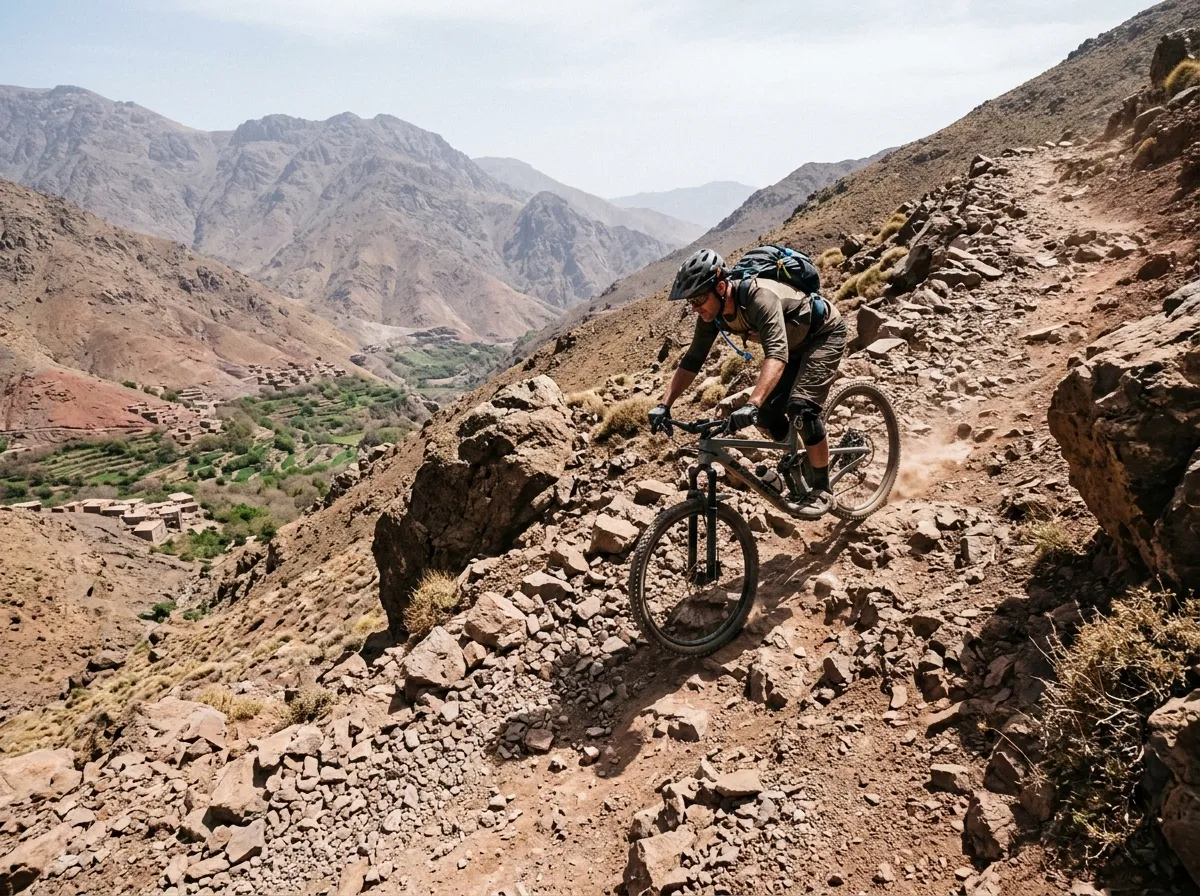
Controlled Descents, Trail Etiquette & Valley Return
For a mountain-bike outing or afternoon hike down from Tizi n’Tamatert, choose a line matched to your skill level and verified with your guide or bike operator (Serenity Morocco Tours). Ride at a controlled speed that allows immediate stopping on loose shale, always yield the right of way to villagers and pack mules, and avoid skidding across agricultural terraces.
Regroup in Imlil village by 16:00 for equipment check-in and mint tea before boarding your return transfer down Route P2017 and R203 to Marrakech before dusk. Travelers extending their journey across Morocco can consult our 7 Days in Morocco by Train or the 8-Day Morocco Coastal Itinerary.
Frequently Asked Logistics & Security Questions
Concrete field answers addressing guide regulations, trail distance and difficulty, currency, mobile coverage, water safety, and emergency contacts in the High Atlas.
How do I plan an Atlas day trekking and mountain biking trip, and is a guide mandatory?
Start by selecting a route that matches your fitness: the Aroumd valley walk is ~4.6–5 km return (+218 m ascent, 1.5–2.5 hours, Easy–Moderate per FriendHike), whereas the climb to Tizi n’Tamatert Pass is ~10 km return (+512–540 m ascent to 2,279–2,287 m, 4–5 hours, Moderate per Riad Jnane Imlil). Morocco regulates the profession of tourist guides, including natural-area guides, as detailed by the Ministry of Tourism. Because local checkpoint rules depend on the specific trail, ask the Bureau des Guides in Imlil about current requirements for your route and verify your guide’s official credentials before departure.
How do travelers avoid unlicensed parking and trail touts upon arriving in Imlil?
Before paying for parking or hiring a guide, confirm the official parking area, current fee, and receipt directly with your accommodation or a clearly identified local information point. Arrange guides through the official Bureau des Guides in Imlil or your registered guesthouse, and confirm credentials, route distance, duration, and total price before agreeing to a service.
Are credit cards accepted in Imlil, and are village ATMs dependable?
Payment methods and ATM availability in mountain villages can change or experience temporary outages. Withdraw sufficient Moroccan dirhams (MAD) in Marrakech before departure to cover shared transport, guide fees, parking, and village lunches, and verify in advance whether your accommodation or tour operator accepts card payments.
What bike should I use for a mountain-bike route around Imlil?
There is no single bike specification for every route around Imlil: paved road climbs toward Tizi n’Tamatert differ greatly from rocky Grade 3–4 mule-track descents. Ask your operator about the exact surface, gradient, and technical difficulty, inspect the hydraulic disc brakes and tire tread before leaving, wear a certified helmet, and skip trails that exceed your riding skill or equipment.
What happens if a mountain bike suffers a mechanical failure high on the ridge?
Repair services and recovery transport vary by valley and trail access. Ask your bike operator before departure what mechanical support, spare parts (tubes, derailleur hanger, multi-tool), and vehicle or mule recovery options are included. Do not continue riding if brakes or steering are compromised.
Can you drink water from mountain streams, or should you carry your own supply?
Always drink sealed bottled water or properly filtered/treated water. Open mountain streams and stone irrigation channels (seguia) flow through grazing pastures and villages upstream and should never be assumed safe for untreated consumption.
Is altitude sickness a concern on a 1-day trek between 1,740 m and 2,600 m?
Strenuous climbing, sun exposure, dehydration, and increasing altitude between Imlil (1,740 m), Tizi n’Tamatert (2,279 m), and Talamrout Summit (~2,600 m) can cause fatigue, headache, or dizziness (Places Without Doors). Pace your ascent, hydrate regularly, and immediately inform your guide and descend if you feel unwell.
How should I plan a safe turnaround time?
Check the mountain weather forecast before leaving Marrakech, consult the Bureau des Guides regarding seasonal snow, heat, or afternoon storm risks in flash-flood ravines, and establish a strict turnaround time with your guide so you return to Imlil well before dusk.
Is Imlil safe for solo female hikers and mountain bikers?
Imlil is one of Morocco’s most established trekking hubs, but conditions and personal experiences vary. Hiring a licensed guide through the official Bureau des Guides or your guesthouse provides local trail knowledge, cultural context, and route support, especially on quieter paths beyond the main village.
Which emergency numbers should I verify before an Atlas trip?
International travel advisories list 177 for the Royal Gendarmerie (outside towns/mountain roads), 150 (or 15 from a landline) for Civil Protection ambulance and fire services, and 190 for urban police. Save these numbers offline and consult the UK government Morocco emergency guidance before travelling.