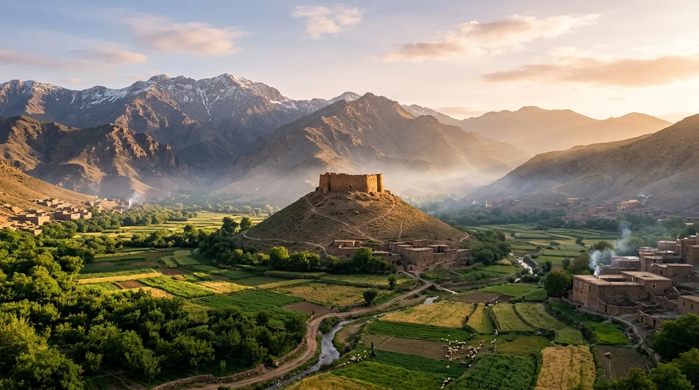
Ait Bouguemez Happy Valley Guide: 6-Day Ultimate High Atlas & Imlil Slow Trip
Ait Bouguemez Happy Valley Guide planning opens the door to Morocco’s most peaceful High Atlas sanctuaries—designed specifically for travelers who want majestic mountain scenery, walnut and apple orchard strolls, and authentic Amazigh hospitality without climbing Mount Toubkal. This field-tested Ait Bouguemez Happy Valley Guide pairs Imlil for non-climbers with the wide, sun-drenched agricultural basin of Aït Bouguemez, comparing paved access routes (R302 Demnate vs. R304 Azilal), gentle valley walks, Jurassic dinosaur tracks, and offline cash logistics. Starting from the Red City? Pair your Ait Bouguemez Happy Valley Guide mountain retreat with our Best Riad in Marrakech guide.
Ait Bouguemez Happy Valley Guide: R302 vs. R304 Road Access & Cash Rules
Before leaving Marrakech with this Ait Bouguemez Happy Valley Guide, understand the difference between the two paved road corridors into Tabant, why ATM cash preparation is mandatory, and how Imlil compares to Aït Bouguemez for non-climbers.
| Ait Bouguemez Happy Valley Guide Stage | Elevation & Drive from Marrakech | Vibe & Landscape Profile | Best Gentle Walk (Zero Summit Climbing) | Ideal Stay & Logistics Note |
|---|---|---|---|---|
| Imlil & Aroumd Basin (Days 1–2) | 1,740 m – 1,900 m · 65 km (1.5 hrs via P2005) | Steep alpine amphitheater beneath 4,167 m Mount Toubkal; walnut & cherry orchards | Imlil to Aroumd & Tamatert Loop (2 hrs, gentle mule track + rooftop mint tea) | 1–2 Nights · Park at guarded Imlil lot (20 MAD/day); luggage carried by mule to kasbahs |
| Demnate & Imi n’Ifri (Day 3 Transit) | 1,100 m – 2,629 m · 175 km from Imlil (3.5 hrs) | Foothill olive groves, travertine cave arch & red-earth high mountain pastures | Imi n’Ifri Natural Bridge Walk (45 mins paved & stone steps through canyon arch) | Lunch & Last ATM / Fuel Stop · Withdraw MAD cash & fill tank 100% in Demnate or Azilal |
| Aït Bouguemez: Agouti & Tabant (Day 4) | 1,800 m – 2,050 m · +70 km (2.0 hrs into valley) | Wide, sunny emerald valley of 27 earthen Amazigh villages, apple & walnut groves | Sidi Moussa Conical Granary Sunset Walk (35–40 mins gentle zig-zag path, +200 m) | 3 Nights Recommended · Zero mass tourism; 360° panorama from 16th-century adobe ighrem |
| Aït Bouguemez: Timit & Ibakliwin (Day 5) | 1,850 m – 1,920 m · 0 km Car Drive Needed | Flat riverside agricultural terraces, irrigation canals (seguia) & Jurassic limestone | Agouti–Timit Riverside Stroll & Dinosaur Tracks (Flat 5 km valley walk, 0% technical incline) | Slow Immersion Day · Walk directly to 165-million-year-old sauropod & theropod footprints |
| Ouzoud Waterfalls & Return (Day 6) | 1,060 m → 466 m · 235 km to Marrakech (4.2 hrs) | Red-cliff 110 m tiered waterfalls, wild Barbary macaques & Haouz plains return | Ouzoud Olive Grove Rim Path (1 hr shaded walkway overlooking the three tiers) | Smooth Return via R304 & N8 · Drop off rental SUV in Marrakech Guéliz or RAK Airport |
Ait Bouguemez Happy Valley Guide Tools: Valley Matcher & Cash Calculator
Use our interactive Ait Bouguemez Happy Valley Guide decision tools below to match your travel window with Imlil or Aït Bouguemez, and calculate your exact mountain budget including the mandatory offline Dirham (MAD) cash reserve.
30-Second Imlil vs. Aït Bouguemez Valley Matcher
Verdict: 6-Day Combined Loop (2 Nights Imlil + 3 Nights Aït Bouguemez)
With 5–6 days, follow our complete Ait Bouguemez Happy Valley Guide loop: combine 2 nights in a panoramic Imlil kasbah (only 90 mins from Marrakech) with 3 nights in an Aït Bouguemez eco-lodge. Drive a compact SUV via Demnate (Imi n’Ifri) going in, and return via the smooth R304 Azilal and Ouzoud Waterfalls highway.
Check Compact SUV Deals & Availability on DiscoverCars6-Day High Atlas Budget & Offline Cash (MAD) Calculator
Estimated 6-Day Total & Mandatory Cash Dirhams
Includes 5 nights half-board lodging, 6-day vehicle/driver, fuel for 540 km, and local walking guides.
Ait Bouguemez Happy Valley Guide Budget: Self-Drive SUV vs. Private Driver
Because family-run eco-lodges in this Ait Bouguemez Happy Valley Guide include generous organic home-cooked dinners and breakfasts (demi-pension), this 6-day circuit delivers exceptional value compared to busy southern tour loops.
| Expense Category (2 People / 6 Days) | Tier 1: Authentic Gîte Self-Drive | Tier 2: Boutique Eco-Lodge SUV (Recommended) | Tier 3: Private 4×4 Chauffeur & Kasbahs |
|---|---|---|---|
| Transport & Vehicle Allocation (6 Days) | $230 – $270 (Compact Crossover) | $310 – $380 (Dacia Duster SUV + Zero-Excess) | $900 – $1,150 (Private 4WD + Licensed Driver) |
| Fuel & Parking Guards (540 km) | $65 – $80 (Diesel + Imlil parking) | $70 – $85 (Diesel + guarded lots) | Included in private chauffeur package |
| Accommodations (5 Nights Half-Board) | $260 – $340 (Traditional village gîtes) | $520 – $680 (Boutique eco-lodges & Imlil kasbah) | $850 – $1,250 (Luxury Imlil suites & private lodges) |
| Local Walking Guides, Mules & Admissions | $60 – $90 (Half-day valley guide + dino site) | $110 – $160 (Private orchard walks & luggage mules) | $150 – $220 (Full private guided walks & picnics) |
| Terrace Lunches, Tea & Cooperative Crafts | $110 – $150 (Village tagines & walnuts/honey) | $180 – $240 (Kasbah rooftop lunches & rugs) | $220 – $300 (Curated garden lunches) |
| Total Outlay for This Ait Bouguemez Happy Valley Guide | $725 – $930 ($362 – $465/person) | $1,190 – $1,545 ($595 – $772/person) | $2,120 – $2,920 ($1,060 – $1,460/person) |
Verified 6-Day Imlil & Ait Bouguemez Happy Valley Guide Itinerary (Non-Climbers)
Follow our chronological Ait Bouguemez Happy Valley Guide stage breakdown designed around gentle orchard walks, panoramic kasbah terraces, fossil sites, and unhurried mountain driving.
Marrakech to Imlil & Aroumd: High Atlas for Non-Climbers
- Driving Distance65 km from Marrakech (1.5 hrs)
- Highway CorridorPaved Route P2005 via Asni
- Walking EffortEasy 2-hr Mule-Path Stroll
- Luggage TransferMuleteer from Imlil Parking
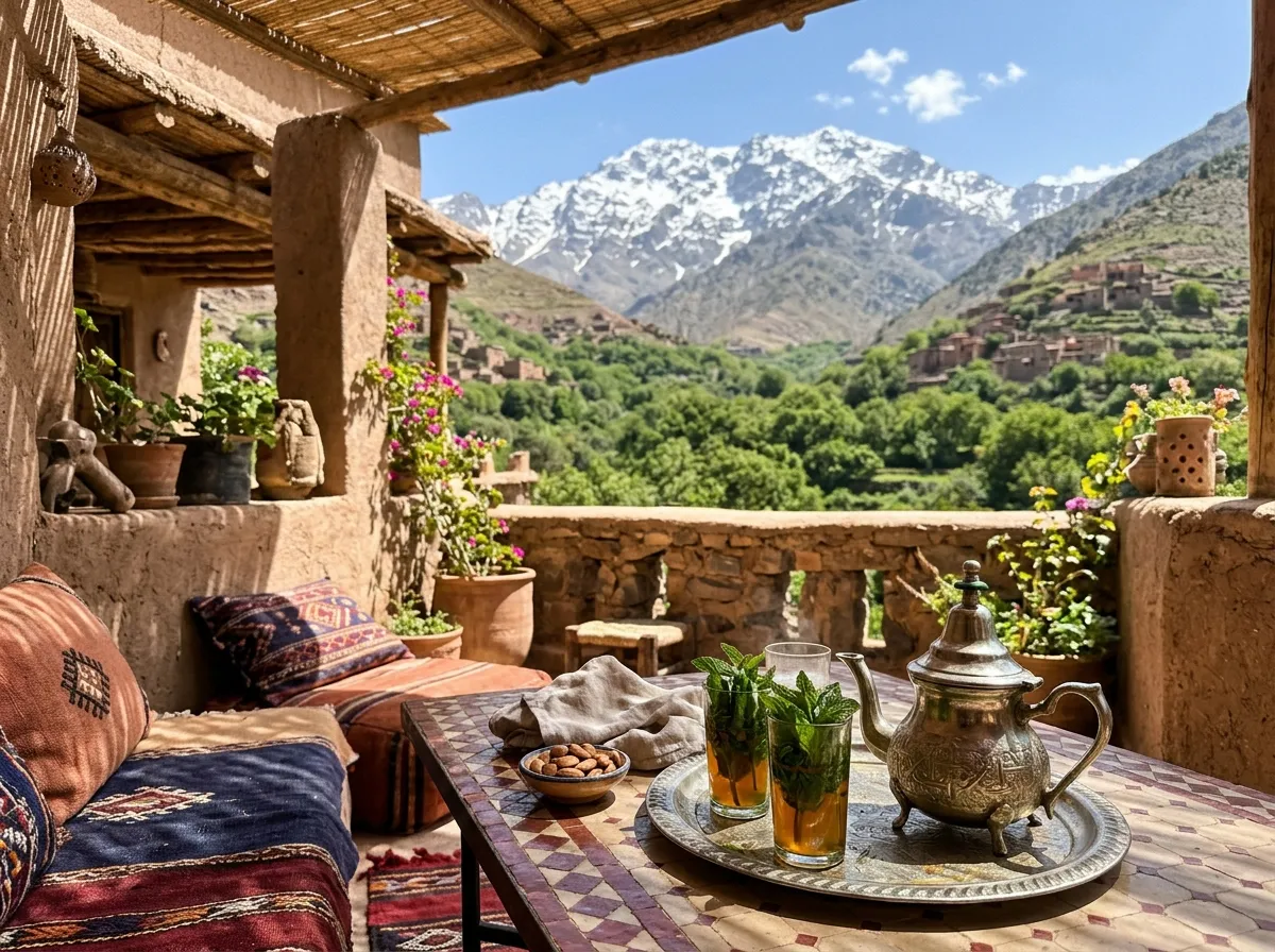
How to Experience Imlil’s Alpine Drama Without Climbing Mount Toubkal
Stage 1 of this Ait Bouguemez Happy Valley Guide departs Marrakech after breakfast along scenic route P2005 through the red-earth Moulay Brahim gorge and Asni (if traveling on a Saturday, pause at the traditional Asni weekly Amazigh souk). Arrive in Imlil (1,740 m), park your vehicle at the guarded village basin lot (20 MAD/day), and let your kasbah’s muleteer carry your bags up the car-free stone paths to your terrace lodge while you walk unencumbered through shaded walnut groves.
Spend Day 2 enjoying Imlil for non-climbers: follow the gentle, non-technical mule track along ancestral irrigation channels (seguias) to the stone village of Aroumd (1,900 m) and the pine-shaded Tamatert viewpoint for a garden tagine lunch facing the 4,167-meter south face of Toubkal—returning in the afternoon for a wood-fired mountain hammam and sunset reading on the terrace.
Imlil to Demnate (Imi n’Ifri) & Entry into Aït Bouguemez
- Driving Distance235 km Total (4.5–5.0 hrs)
- Route OptionsR302 Demnate or R304 Azilal
- Midday LandmarkImi n’Ifri Natural Rock Arch
- Mandatory StopATM Cash & 100% Fuel in Town
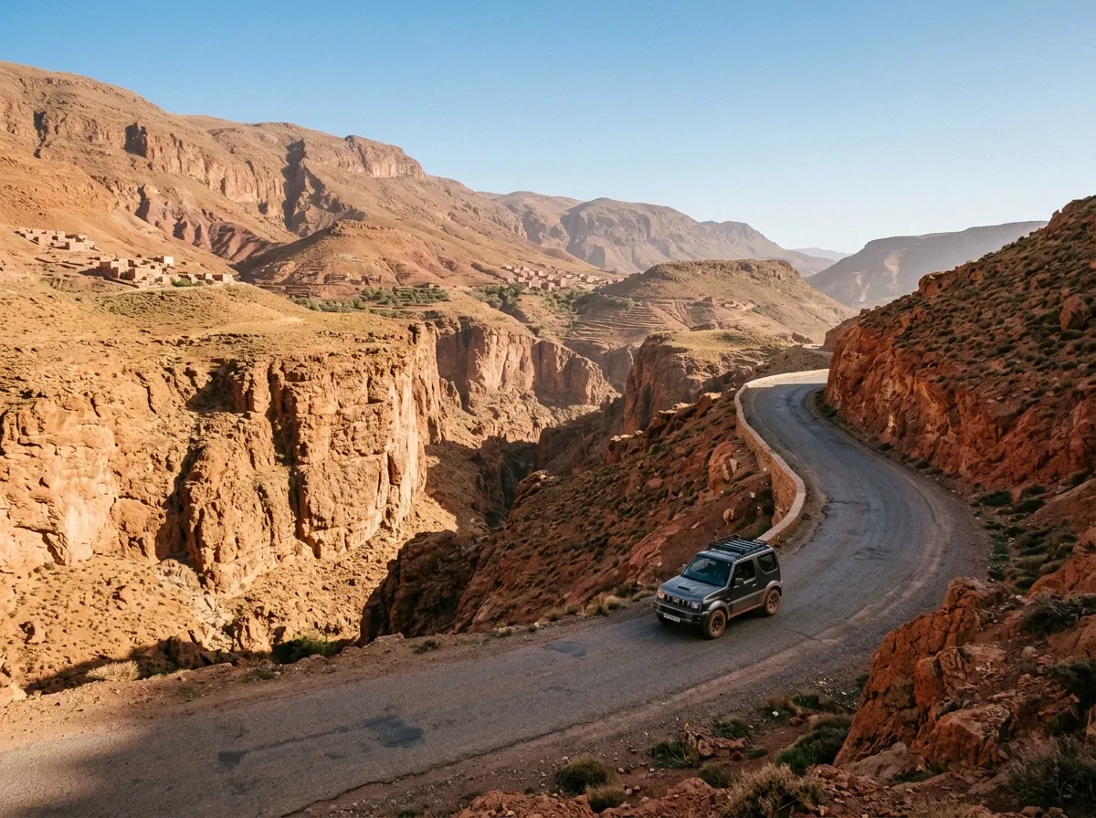
Imi n’Ifri Natural Bridge, Last ATM Cash Stop & Descending into Agouti
On Day 3 of our Ait Bouguemez Happy Valley Guide, descend from Imlil to the foothill town of Demnate. Before heading higher, stop at a bank ATM and service station in Demnate (or Azilal if taking R304) to withdraw 2,500–3,500 MAD cash and fill your tank to 100%, as Aït Bouguemez has no bank ATMs or major fuel stations. Just 6 km outside Demnate, stretch your legs on a 45-minute walk through the spectacular Imi n’Ifri Natural Bridge, a giant travertine cave arch spanning the Tissilt river canyon.
From May to October in clear weather, continue along scenic paved route R302 across high-altitude pastures and the 2,629-meter Tizi n’Tirghist pass; in winter (November–March) or after heavy rain, take the wider, lower-altitude R304 highway via Azilal and Aït M’hamed. By late afternoon, drop into the western entrance of the valley at Agouti (1,800 m) and check into a traditional rammed-earth eco-lodge.
من فضلك، املأ الخزان بالكامل بـ (مازوط ممتاز). هل الطريق رقم R302 (تيزي نترغيست) أو R304 إلى آيت بوكماز (تابانت) مفتوحة وجيدة اليوم؟
« Bonjour, le plein de Gasoil Sans Soufre s’il vous plaît. Est-ce que la route vers Aït Bouguemez (Tabant) par R302 ou R304 est bien dégagée aujourd’hui ? Merci ! »
Sidi Moussa Conical Granary & Ibakliwin Dinosaur Tracks
- Driving Distance12 km Valley Road (Or Walk)
- Morning Discovery165M-Year Dinosaur Tracks
- Sunset HighlightSidi Moussa Adobe Granary
- Sunset Ascent35-min Graded Zig-Zag Path
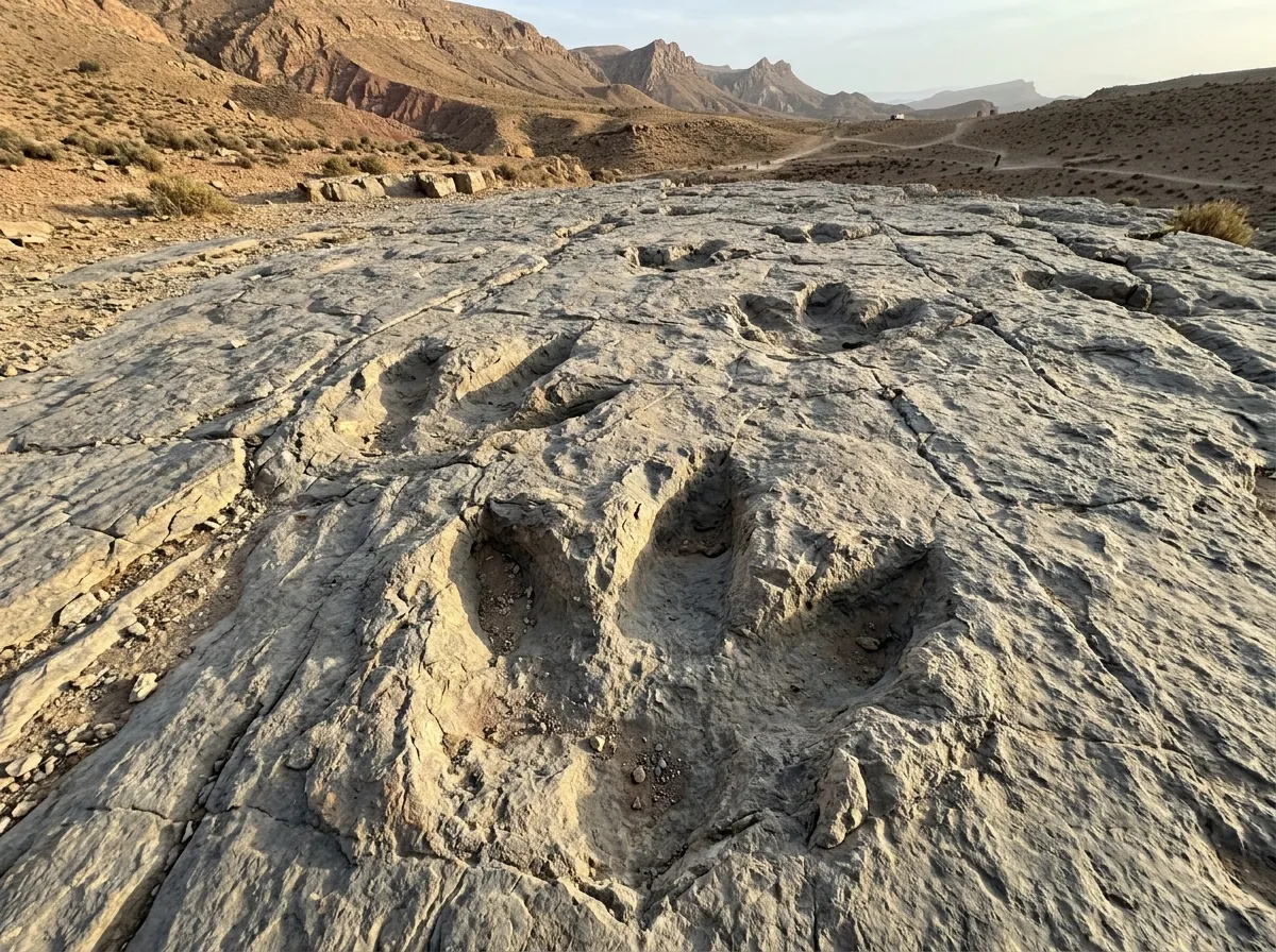
Jurassic Geopark Heritage & 360° Views from the Pyramid of Sidi Moussa
Day 4 is the cultural highlight of this Ait Bouguemez Happy Valley Guide. Wake up to crisp mountain silence and birdsong across the orchards, then spend the morning in the eastern village of Ibakliwin (part of the UNESCO M’Goun Global Geopark), where a flat, accessible limestone slab right beside the village path preserves unmistakable 165-million-year-old footprints of both three-toed carnivorous theropods and giant herbivorous sauropods. Afterward, visit a local women’s weaving cooperative in Tabant or Timit to see traditional high-pile Azilal and Bouguemez wool carpets woven on vertical looms.
An hour before sunset, walk the gentle, well-graded 35-minute switchback footpath up the symmetrical conical hill crowning the center of the basin to the Marabout and Collective Granary (Ighrem) of Sidi Moussa (2,050 m). Built in earthen pisé to store grain and valuables for the surrounding clans, the circular fortress rewards you with a 360-degree golden-hour panorama over all three branches of the Happy Valley.
Agouti to Timit Flat Riverside Walk, Bread Ovens & Slow Living
- Driving Distance0 km (100% Car-Free Day)
- Walking Distance5–7 km Flat Valley Stroll
- Elevation GainUnder 80 m (Zero Steep Climb)
- Cultural FocusTafarnout Bread & Honey
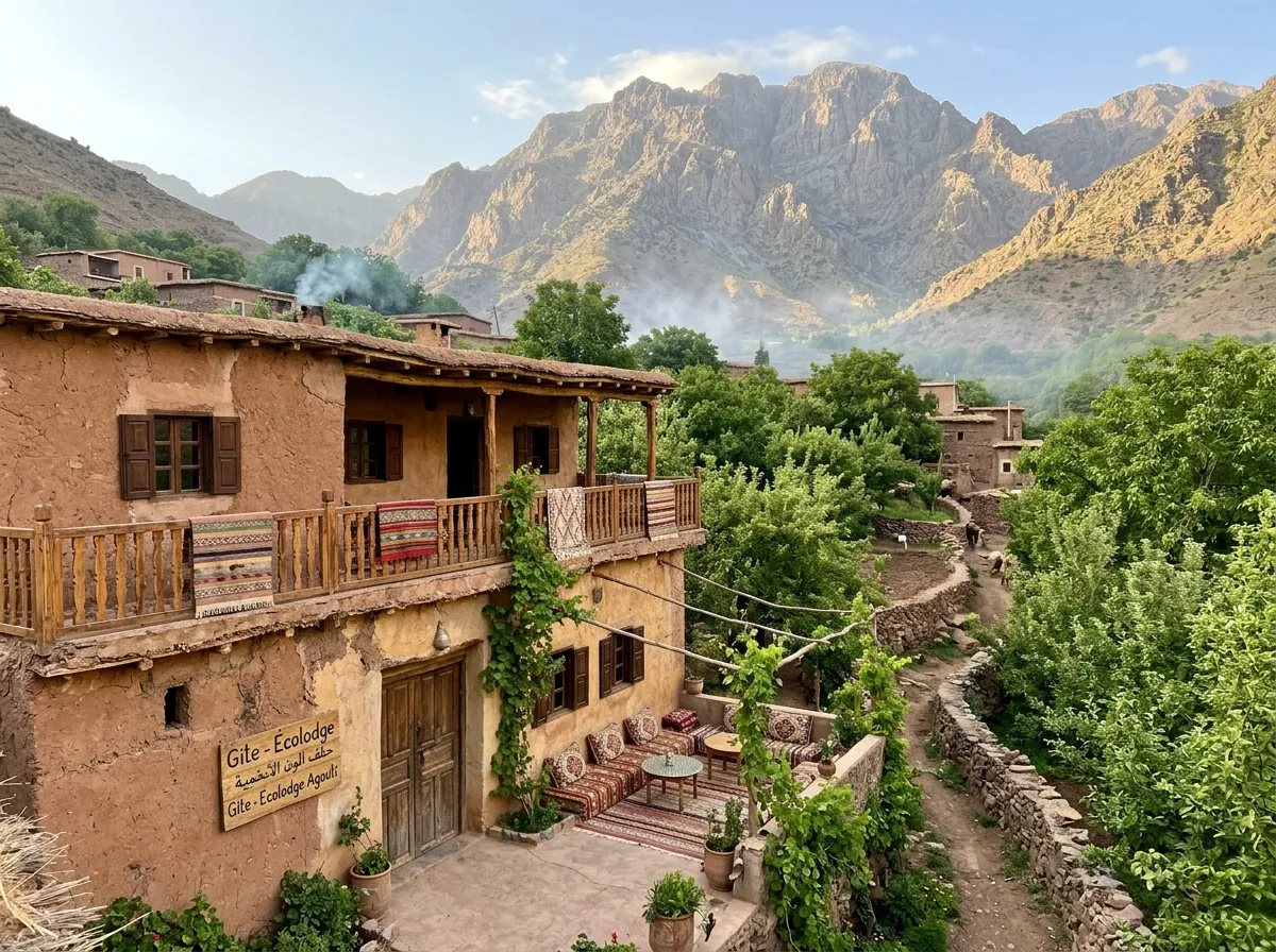
Why 3 Nights in This Ait Bouguemez Happy Valley Guide Is the Ultimate Digital Detox
Leave your car keys at the lodge for a full car-free day in the heart of this Ait Bouguemez Happy Valley Guide circuit. Hire a certified local village guide (250–350 MAD for a leisurely half-day) to stroll the flat, shaded path alongside the snowmelt-fed Bouguemez stream linking Agouti, Aït Imi, and Timit. Walk beneath centuries-old walnut trees and neatly pruned apple orchards while learning how village assemblies (Jmaa) share water through ancestral earthen canals.
Join your host family at midday to bake traditional barley and wheat flatbread (tafarnout) in a wood-fired earthen oven, drizzled with local mountain thyme honey and freshly pressed walnut oil. Spend the afternoon reading in a hammock, practicing yoga on the sunny roof terrace, and stargazing under zero-light-pollution skies.
Aït Bouguemez to Marrakech via Azilal & Ouzoud Waterfalls
- Driving Distance235 km (4.0–4.5 hrs Drive)
- Highway CorridorAll-Weather R304 → N8
- Midday Detour110 m Ouzoud Waterfalls
- Car Drop-OffMarrakech Guéliz or RAK
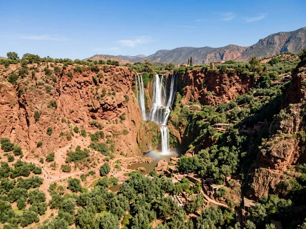
Returning via Route R304 (Azilal) & the 110-Meter Cascades d’Ouzoud
On the final morning of this Ait Bouguemez Happy Valley Guide, enjoy a breakfast of fresh mountain apples, pancakes (msemen), and mint tea before exiting the valley westward via the smooth, well-engineered Route R304 through Aït M’hamed and Azilal. Completing a loop (entering via Demnate R302 and exiting via Azilal R304) means you never retrace the same mountain road twice.
Thirty minutes northwest of Azilal, detour to the Ouzoud Waterfalls—North Africa’s highest tiered cascades plunging 110 meters into a red-rock amphitheater ringed by olive groves and wild Barbary macaques. Enjoy a shaded riverside lunch overlooking the falls before rejoining highway N8 across the Haouz plains back to Marrakech, where you can check into a medina sanctuary from our Best Riad in Marrakech shortlist or head to RAK Airport via our Marrakech Departure Logistics Guide.
Ait Bouguemez Happy Valley Guide Packing List (No Alpinism Gear Needed)
You do not need crampons, heavy mountaineering boots, or sub-zero sleeping bags for this Ait Bouguemez Happy Valley Guide circuit—just smart 1,850-meter layering and offline essentials.
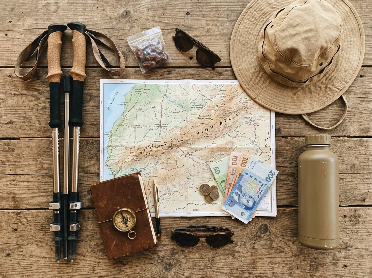
Valley Walking Apparel & Layers
- Grippy Trail Sneakers: Lightweight trail-running shoes or flexible walking shoes are ideal for stone mule paths and orchard trails.
- Warm Evening Fleece or Down Jacket: At 1,850 m, temperatures drop 12–15°C as soon as the sun dips behind the ridges.
- Modest, Breathable Daywear: Loose linen or merino layers covering shoulders and knees out of respect for rural Amazigh villages.
- Collapsible Walking Poles: Helpful for protecting knees on the 35-minute descent from Sidi Moussa Granary.
- Slip-On Lodge Sandals & Wool Socks: Cozy indoor footwear for earthen eco-lodge dining rooms.
Cash, Navigation & Health Kit
- 2,500–3,500 MAD Cash Reserve: Carry 50, 100, and 200 MAD banknotes in a money belt (no ATMs in Tabant or Agouti).
- Offline Maps (Organic Maps / OsmAnd): Download the Morocco region on Wi-Fi before leaving Marrakech.
- Water Bottle with Filter / Tablets: Avoid buying single-use plastic bottles in pristine mountain valleys.
- 20,000 mAh Power Bank: Keeps phones and cameras charged during full-day orchard picnics.
- High-Altitude SPF 50+ & Lip Balm: UV radiation at 2,000 meters is intense even on cool spring days.
Local Tip — What to Buy Directly in the Valleys:
Leave space in your luggage for pure High Atlas walnut oil, organic mountain apples, wild euphoria/thyme honey, and hand-woven Azilal/Bouguemez wool rugs bought directly from village women’s cooperatives in Tabant and Imlil at zero middleman markup.
Extend Your Ait Bouguemez Happy Valley Guide: Stays, SUVs & Next Routes
Access all verified partner booking links and the printable PDF Field Guide for this Ait Bouguemez Happy Valley Guide in one place, or combine your mountain retreat with our signature Sahara road loop or Atlantic surf coast itinerary.
10 Day Morocco Sahara Itinerary: High Atlas, Gorges & Erg Chebbi
Want to continue south from the Atlas into the Sahara? Follow our 1,180 km paved circuit through Aït Benhaddou, Dadès and Todra Gorges, Erg Chebbi luxury desert camps, and the Drâa Valley.
8-Day Morocco Coastal Itinerary: Essaouira, Imsouane & Taghazout
Pair mountain orchards with Atlantic ocean breezes. Follow coastal highway R301 from UNESCO-listed Essaouira to the slow-travel surf bay of Imsouane and Taghazout.
Frequently Asked Questions: Ait Bouguemez Happy Valley Guide & Imlil
Direct, field-verified answers for your Ait Bouguemez Happy Valley Guide covering non-climber walks in Imlil, how to reach Aït Bouguemez from Marrakech, R302 vs. R304 road safety, ATM availability, altitude, and family travel.
1. Is Imlil worth visiting in this Ait Bouguemez Happy Valley Guide if you do not climb Mount Toubkal?
Yes. Over 60% of visitors to Imlil never climb Toubkal. Non-climbers following this Ait Bouguemez Happy Valley Guide can stroll gentle stone mule paths beneath centuries-old walnut and cherry orchards linking Imlil, Tamatert, and Aroumd (1,740 m–1,900 m), savor rooftop mint tea and tagines facing the 4,167 m summit, and relax in boutique mountain kasbahs with traditional hammams.
2. How do you get to Aït Bouguemez (Happy Valley) from Marrakech?
As mapped in this Ait Bouguemez Happy Valley Guide, the valley lies 210–235 km east of Marrakech (4.0 to 4.5 hours by car) via two paved routes: Route R304 via Azilal and Aït M’hamed (wider all-weather highway, best year-round and in winter) or Route R302 via Demnate and Imi n’Ifri over the 2,629 m Tizi n’Tirghist pass (narrower, dramatic high-mountain scenery best from May to October). You can also take a grand taxi or bus from Marrakech to Azilal and a shared transit van into Tabant.
3. Do I need a 4×4 to drive the routes in this Ait Bouguemez Happy Valley Guide?
A 4×4 is not strictly necessary in dry weather because routes P2005 (Imlil), R304 (Azilal), and R302 (Demnate) in this Ait Bouguemez Happy Valley Guide are paved. However, renting a compact SUV or crossover (such as a Dacia Duster) is strongly recommended for higher ground clearance when pulling onto gravel shoulders to let oncoming trucks pass and climbing unpaved eco-lodge driveways.
4. Are there ATMs or credit card terminals in Aït Bouguemez (Tabant)?
No. There are no bank ATMs inside the Aït Bouguemez valley, and nearly all family-run eco-lodges, gîtes, mountain guides, and weaving cooperatives operate 100% in cash. Withdraw at least 2,500–3,500 MAD in Marrakech, Demnate, or Azilal before entering the valley.
5. What is the difference between Imlil and Aït Bouguemez for slow travelers?
Imlil is a steep, dramatic V-shaped alpine valley only 90 minutes from Marrakech with upscale boutique kasbahs—perfect for a 1–2 night acclimatization stay. Aït Bouguemez (4.5 hours from Marrakech) is a wide, flat-bottomed, sun-drenched agricultural basin stretching 30 km across 27 earthen Amazigh villages, offering flat riverside walks, dinosaur fossils, and almost zero mass tourism.
6. What are the best easy walks in this Ait Bouguemez Happy Valley Guide for non-hikers?
The three best gentle walks in our Ait Bouguemez Happy Valley Guide are: (1) the 35-minute zig-zag sunset path up to the conical Sidi Moussa Granary (2,050 m), (2) the flat 5 km riverside walk between Agouti, Aït Imi, and Timit through shaded apple and walnut orchards, and (3) the flat village walk in Ibakliwin to inspect the 165-million-year-old Jurassic dinosaur footprints.
7. Will I experience altitude sickness in Imlil or Aït Bouguemez?
No. Unlike climbing Mount Toubkal (4,167 m), staying on the valley floors of Imlil (1,740 m) and Aït Bouguemez (1,800 m–2,000 m) keeps you well below the 2,500-meter threshold where acute mountain sickness typically begins, making both valleys safe and comfortable for seniors and young children.
8. When is the best time of year to use this Ait Bouguemez Happy Valley Guide?
April to June (apple and cherry blossoms, lush green barley fields, rushing snowmelt streams) and September to October (apple and walnut harvest season with golden autumn foliage and crisp 22°C afternoons) are peak slow-travel windows for this Ait Bouguemez Happy Valley Guide. July–August is a cool 26–28°C refuge from Marrakech’s 42°C heat, while December–February brings snow-capped peaks and cold nights requiring heated lodges.
9. Is there Wi-Fi and 4G cellular reception in Aït Bouguemez and Imlil?
Yes. Village centers in Imlil, Agouti, Tabant, and Timit have reliable 4G mobile coverage (Maroc Telecom and Orange perform best in the High Atlas), and most boutique eco-lodges provide Wi-Fi in common areas—allowing you to stay reachable while enjoying a peaceful digital detox.
10. Do I need to hire a guide for gentle valley walks in Aït Bouguemez?
You can walk the main valley floor and climb Sidi Moussa hill independently, as the local atmosphere is completely relaxed and hassle-free. However, hiring a certified local Tabant guide for a half-day (250–350 MAD) unlocks invitations into village bread ovens, water mills, and women’s rug cooperatives that independent walkers would otherwise miss.
11. Where exactly are the dinosaur footprints in Aït Bouguemez?
The fossilized tracks are located on an exposed inclined limestone slab in the village of Ibakliwin, about 4 km east of Tabant center. Both three-toed carnivorous theropod tracks and round elephant-like sauropod impressions are clearly visible outdoors free of charge (a small tip of 20–30 MAD for the local site guardian is customary).
12. Is Aït Bouguemez safe for solo female travelers and families with children?
Aït Bouguemez is widely considered one of the safest, most welcoming rural communities in Morocco. Because its economy is rooted in family agriculture and community-based eco-tourism rather than mass day-trippers, there are zero touts or aggressive sales pitches. Wearing modest layers that cover shoulders and knees ensures warm, respectful interactions across all 27 villages.
Ait Bouguemez Happy Valley Guide Verified by the Morocco Wayfinder Team
This Ait Bouguemez Happy Valley Guide and Imlil slow-travel dossier was researched, mapped, and fact-checked by the Morocco Wayfinder Team (About Our Editorial Process ↗) to provide travelers with verified road conditions, altitude profiles, and cultural protocols. Mountain pass conditions on R302 can shift after winter snowfall; always verify live status before departure.
| Verification Domain | Primary Institutional / Authoritative Source | Key Verified Data Point |
|---|---|---|
| UNESCO Geopark & Fossils | UNESCO M’Goun Global Geopark | Ibakliwin 165-million-year-old Jurassic sauropod/theropod tracks, Imi n’Ifri travertine arch & Sidi Moussa heritage |
| Mountain Highway Network | Ministry of Equipment & Water (Morocco) | Paved status of P2005 (Imlil), R304 (Azilal–Aït M’hamed–Tabant), and R302 (Demnate–Tizi n’Tirghist 2,629 m) |
| Cellular & Mountain QoS | ANRT National Mobile QoS Reports & nPerf Morocco Map | 4G coverage in Imlil, Agouti, and Tabant centers vs. signal dropouts along high mountain passes |
| Emergency & Rural Safety | Visit Marrakech CRT & UK FCDO Morocco Guidance | Royal Gendarmerie (177), Protection Civile Mountain Rescue (15 / 150), SAMU (141) & Tourist Police |